|
A Journey through Forests and Parks in the Galilee |
|
|
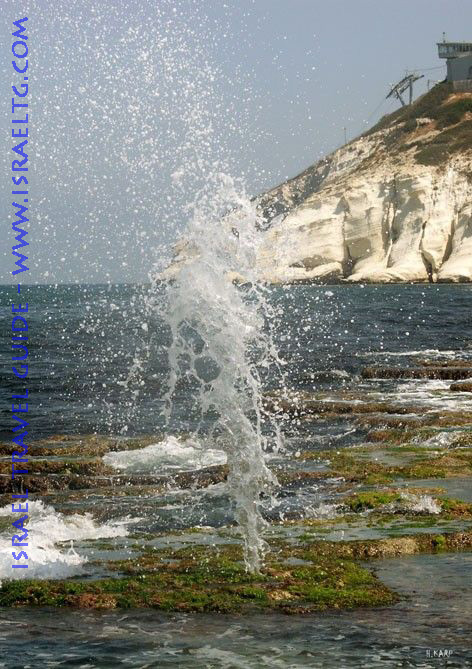
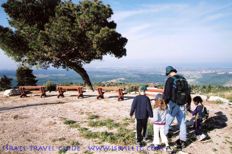
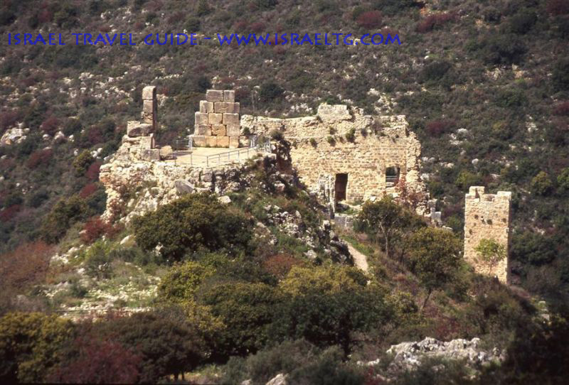
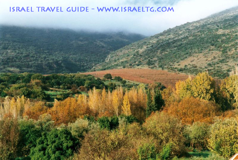
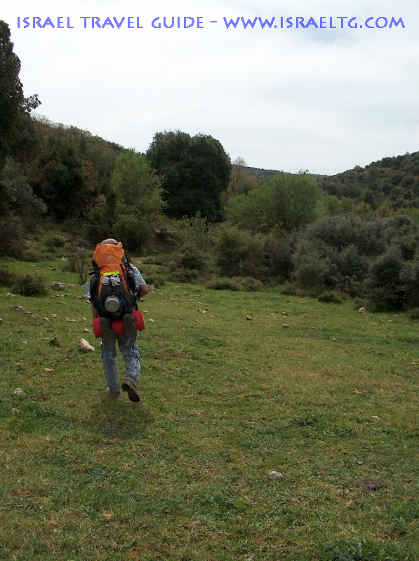
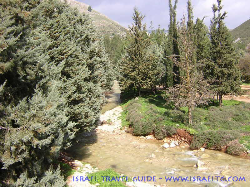
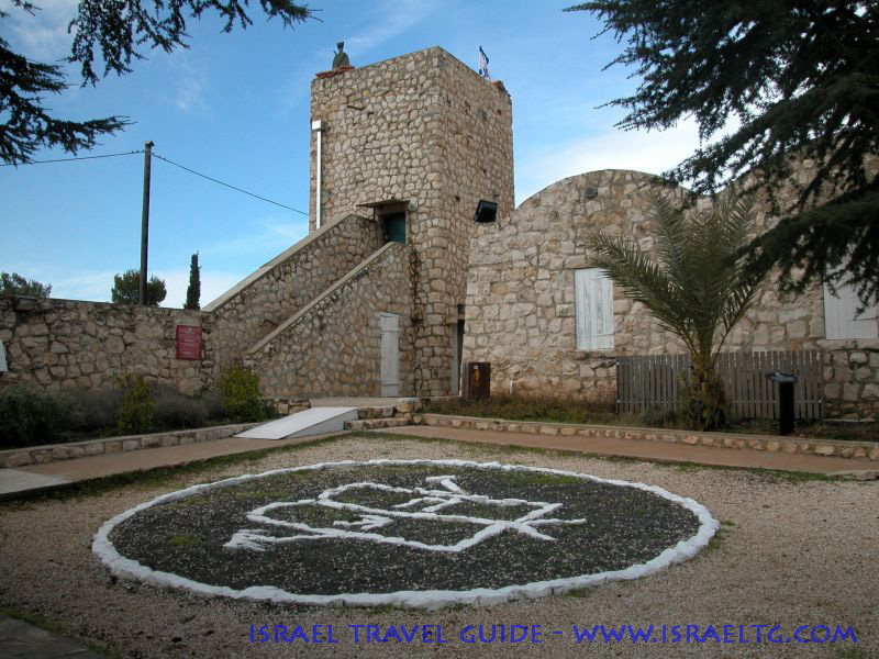
A hiking route that passes through KKL (Keren Kayemeth LeIsrael - Jewish National Fund) forests and parks open to the public from the shores of the Mediterranean through the peaks of the Upper Galilee Throughout the Galilee are lookouts, car parks and forests that enable visitors to watch the views of the area and enjoy the sights, views and the green that captures the eyes. In recent years, KKL has invested in developing road infrastructures in these sites, and now all that remains is to drive, stop and be impressed by the views of the Galilee in spring. The Achzib Promenade and Rosh HaNikra Our journey begins at the Achzib view - Bezet road along the Mediterranean in the western part of the Galilee. The road begins near the Yad-LeYad monument in Achzib and leads to the train tunnel in Rosh HaNikra. The road, with a length of 3.5 kilometers, is suitable for hikers as well as bicyclers. It crosses the Bezet River using a reconstructed bridge that was used by the train from Haifa to Beirut during the British rule. The paved road turns the shoreline into a unique promenade heading north towards the edge of the "Ladder of Tire" and the grottos that cut through the white cliffs of Rosh HaNikra. It is highly recommended to stop in the car parks along the road, listen to the waves and watch the foaming waves shatter on the shore. Adamit Park and Keshet Cave After leaving the Achzib shores, turn east towards Bezet junction and follow "Kvish Hatsafon" (the northern road) towards Shlomy. A few kilometers later, you'll reach a junction of road number 899 and road 2245, which winds northwards and passes next to the Keshet Cave on its way to the Adamit Park. This park lies at one of northern Israel's most spectacular spots. From the car parks and the lookouts in the site, the views of the western Galilee, the shores of the Mediterranean and the Haifa bay can be seen. For the comfort of visitors, KKL has prepared paved, wheelchair accessible hiking paths, green toilets, picnic tables, water fountains and benches with a unique designs, as well as a variety of species of trees such as pedunculate oaks, cedars, Judas trees, carob trees, pistacias and pine trees. From the park, a hiking path descends to the Keshet (rainbow) Cave. At the end of the tour through the park, return to the Shlomy-Ma'alot road and turn right to the Goren after Kibbutz Ayalon. Kziv River and the Montfort Fortress The Goren Park offers visitors and holidaymakers fresh air, car parks shaded by wide treetops, Mediterranean groves and a view of the Kziv River creek and the Montfort Fortress, one of the most impressive Crusader ruins in Israel. The Montfort Fortress is also known by its Arab name "Kalaat Kurin", meaning the small horn fortress, due to its location at the edge of a steep extension over the river's path. "The Montfort" is the remains of a large agricultural farm that existed there during the time of the Crusaders. Later, it was used as a fortress to defend routes that led from the shores to the center of the Galilee. In the past, vultures and eagles nested here, and today, between the rocks and bushes, hyraxes, mongooses and wild boars can be found. Mount Meron and the Baram Forest On your way east along Kvish Hatsafon there are several more green and inviting sites. On your south you can see the peaks of Har Adir and Har Hiram and even ascend to the forest car park at the peak of Mount Meron, at an altitude of 1208 meters above sea level. This is one of the most spectacular viewpoints in the entire Upper Galilee. The Druze villages of Hurfeish and Beit Jan will be spanned at your feet, and further away you can see the peaks of the Lower Galilee and the views of the Sea of Galilee. You can take a circular pedestrian path at the peak, showing the views of Lebanon, the Hula Valley, Mount Hermon and the Golan Heights. When you've had enough of the views, descend back to Kvish Hatsafon, pass Kibbutz Sassa and the Hiram Junction on your way to the Baram Forest. Here, you can take a short hike shaded by the thick trees of the forest, or continue towards the Rabin Forest car park to relax in the shade of the pine trees along the edges of the beautiful road descending to the Dishon River. Further along, you may enjoy the facilities of the Ein Zeytim car park, but it seems that all this abundance cannot fit into the already crammed itinerary. You could stay overnight in one of the rustic vacation sites scattered along the area's Kibbutzim and Moshavim, but if you're short in time, you should probably prefer to continue on your way to the Biriya Forest. The Biriya Forest and Fortress The Biriya Forest is one of the most important forests in our country. 20 thousand dunam of slopes descend from Safed to Rosh Pina. This forest holds everything a tourist may seek: orchards, ancient ruins, Talmudic synagogues (3rd-6th centuries BC). Tombs of saints as well as hiking paths, car parks and lookouts. The peaks of the forest reach 900 meters, and ensure a cool and pleasant air. At the center of the forest stands the Biriya Fortress with an audio-visual display and multimedia activities. The Biriya Fortress signifies, more than anything else, the struggle of the Jewish people to settle their lands. During Israel's fight for independence it was seized by young fighters that made their way in the dark of night to ensure the protection of the area by controlling the fortress, which overlooks Safed and the Upper Galilee. The fortress was reconstructed with the help of KKL (Keren Kayemeth LeIsrael - Jewish National Fund) and is currently used as a visitors' center. From here you can take a tour through the alleys of Safed, but if you with to continue on your green tour, head north on road number 886 towards Metzudat Koach and the Kadesh River. Metzudat Koach and the Kadesh River Park On your way towards Metzudat Koach you will pass along the Circassians village of Reyhaniya, cross the Dishon River and reach the KKL observation point, overlooking the Hula Valley and the Golan Heights at the feet of Moshav Ramot Naftali. Another spectacular view is awaiting you at the Nebi Yusha Police Station, also known as Metzudat Koach. Here, next to the monument commemorating Palmach warriors that fell during the battle to occupy the fortress, you can relax in a car park, enjoy the views of the Hula Agmon at the center of the valley, or continue along road 899, winding its way towards the Kadesh River Park. The park is located at the origin of the Kadesh River, along the edges of the Hula Valley, about seven kilometers south of Kiryat Shmona. KKL has set up a car park, hiking routes, sitting areas and playgrounds. During the winter and spring, water descending from the top of the rivers' falls can be seen further along the path. You may cross bridges over the creeks and hike among the lush and diverse vegetation. From here, driver one kilometer further east to end the tour at the Koach Junction on road number 90 .
|
|